Please find below Mississippi River daily report for June 28, 2024
A Daily Publication of the New Orleans Board of Trade
07:15 hrs. - 06/28/2024
New information (Except for the Air Draft, River Stages, and Vessel Information) is highlighted in Green
The Controlling Draft for Deep Draft Vessels is 50 Feet. There is one dredge working in Southwest Pass.
Pilot Recommendations: Bar Pilots: Recommended maximum loading draft: 50 Feet. The Bar Pilots are recommending that inbound ships with a draft of 38' or greater only transit six (6) hours before to four (4) hours after high tide due several vessels experiencing heavy flocculation in SWP. This does not prevent a pilot from exercising their own judgement.
Crescent Pilots: Recommended maximum loading draft: 50 Feet. NOBRA Pilots: Recommended loading draft is as follows: 50 feet from New Orleans to Mile 175 ; 47 Feet from Mile 175 - Mile 180; 45 feet from Mile 180 to Mile 234. Vessels with a draft of 41 feet or greater are required to transit the Baton Rouge Harbor (Mile 180 - Mile 234) during daylight hours only.
NOBRA Pilots - High Interest Vessels Vessels classified as HIGH Interest by the Coast Guard, A Federal Authority, Any State Authority, or the NOBRA Board of Directors, may require 2 pilots and be limited to daylight transit only along the NOBRA Route. Any customer of the NOBRA Pilots, docks, berths, moorings, agents, owner, or owner representative may petition the NOBRA Board of Directors to establish or remove the HIV classification. PER THE NOBRA PILOTS, A VESSEL ONLY REQUIRING A CREW CONTROL SECURITY PLAN (CCSP) BY THE COAST GUARD WILL NOT BE SUBJECT TO THE 2 PILOT RULE.
Federal Pilots: Recommended maximum loading draft:50 feet from the Sea Buoy to Mile 175; 45 feet from Mile 175 – Mile 232.4; and 40 feet from Mile 232.4 – Mile 233.8.
U.S. Coast Guard Notices: CARROLLTON GAUGE AT 9 FEET AND FALLING This Marine Safety Information Bulletin supersedes Volume XXIV, Issue 044 “Carrollton Gauge at 12 Feet and Falling”. The Carrollton Gauge reads below 9 feet, the following measures are no longer in effect:
As per 33 CFR 161.65, the Governor Nicholls traffic light, Gretna Harbor traffic light, and Westwego traffic lights are energized. The Governor Nicholls Navigation Light and Gretna Navigation Light are extinguished.
As required by 33 CFR 165.810(b)(3), tows are prohibited from transiting VTS special areas by a vessel with insufficient power to permit ready maneuverability and safe handling (unable to maintain an average speed of at least 3 MPH (2.6 knots).
For all vessels operating in the Lower Mississippi River (LMR) below Mile Marker (MM) 233.9 Above Head of Passes (AHP), including South Pass and Southwest Pass, additional high-water requirements are found in Title 33 of the Code of Federal Regulations (CFR) 165.810.
All Deep Draft vessels to include Ocean-going Towing vessels should have three means to hold position unless moored to shore or a mooring buoy.
Downbound Ocean-going Towing vessels towing on the hawser should consult with the appropriate pilot association to determine the need for assist tug.
Towing vessels should review MSIB Vol XIX Issue 007 titled Towing Vessel Safety Advisory During High Water, issued 15 January 2019 for additional provisions.
Waterway Status – Fireworks Displays within the COTP New Orleans Zone July 3 and July 4, 2024 The U.S. Coast Guard (USCG) Captain of the Port New Orleans, under the authority of the Ports and Waterways Safety Act, is enforcing reoccurring safety zones defined in 33 CFR 165.801 within the Captain of the Port New Orleans area of responsibility. These safety zones are needed to protect persons and vessels from the potential safety hazards associated with waterborne activities and fireworks displays. Below is a list of dates and times established safety zones will be enforced.
1. St. John the Baptist/Independence Day Celebration a. Date and time: July 3, 2024 from 8:45 p.m. until 9:45 p.m. b. Location: Lower Mississippi River Mile Marker (MM) 137.5 to MM 138.5 Above Head of Passes (AHP), Reserve, LA c. Designated representative: USCG Station New Orleans, VHF-FM Channel 67
2. Madisonville Old Fashion 4th of July a. Date and time: July 4, 2024 from 8:30 p.m. until 9 p.m. b. Location: Tchefuncte River, 100-yard radius around 30°24′11.63” N, 090°09′17.39” W, in front of Madisonville Town Hall c. Designated Representative: St. Tammany Parish Sheriff Office, POC: Officer Brady (985) 276-1396, Officer McCrea (985) 960-1120
3. Go 4th New Orleans/Independence Day Celebration a. Date and time: July 4, 2024 from 8:30 p.m. until 9:30 p.m. b. Location: Lower Mississippi River MM 94.3 to 95.3 AHP, New Orleans, LA Designated Representative: USCG Station New Orleans, VHF-FM Channel 67
4. L’Auberge Casino Fireworks a. Date and time: July 4, 2024 from 8:30 p.m. until 9:30 p.m. b. Location: Lower Mississippi River MM 216.5 to 217.5 AHP, Baton Rouge, LA c. Designated representative: East Baton Rouge Parish Sheriff’s Office, VHF-FM Channel 67, or phone (225) 733-8085
5. WBRZ-TV Fireworks Display a. Date and time: July 4, 2024 from 8:30 p.m. until 9:30 p.m. b. Location: Lower Mississippi River MM 228.8 to 230 AHP, Baton Rouge, LA c. Designated representative: East Baton Rouge Parish Sheriff’s Office, VHF-FM Channel 67, or phone (225) 733-8085
All vessels are prohibited from entering these safety zones unless they have been granted permission by the Captain of the Port New Orleans or designated representative. The Captain of the Port’s designated representative for each safety zone is listed above. All vessels requesting permission to enter or transit through these safety zones are required to contact the designated representative via the contact methods listed above. Each designated representative will evaluate and allow vessels to transit through the safety zone on a case-by-case basis.
Coast Guard - Hurricane Season 2024 The 2024 Hurricane Season commences June 1st and continues through November 30th. You are strongly encouraged to review your existing hurricane plan or develop a plan if you do not have one. It is extremely important to decide in advance how to minimize your risk and be prepared to evacuate as necessary.
The Captain of the Port (COTP) will set hurricane port conditions in accordance with the Sector New Orleans Maritime Hurricane Contingency Port Plan (MHCPP). The MHCPP is available on the Coast Guard Homeport website https://homeport.uscg.mil/port-directory/new-orleans. This plan describes actions the COTP will take in anticipation of a hurricane or tropical weather conditions, outlines the requirements of each port condition, and includes information regarding vessel movements and mooring requirements during anticipated landfall.
Starting this hurricane season, COTP New Orleans will transition from paper to electronic forms for all MHCPP hurricane reporting forms. Electronic reporting will expedite our ability to gather and distribute time-sensitive information. These electronic forms are for reporting to the COTP New Orleans only and shall not be used for any party or entity in another COTP Zone. All COTP New Orleans MHCPP hurricane forms can be accessed using the QR Code below or at https://linktr.ee/secnolahurricanereporting. Please provide feedback or issues experienced to SecNOLA-WPM@uscg.mil.
Furthermore, the COTP emphasizes the importance of properly maintaining and securing your equipment during hurricane season. Important hurricane-related information will be provided to the maritime community, as needed, through Marine Safety Information Bulletins (MSIBs), Broadcast Notice to Mariners (BNMs), and industry-wide emails.
Regulated Navigation Area (RNA) Annual Hurricane Operation Plans
In accordance with Title 33, Code of Federal Regulations (CFR), Part 165.838, all floating vessels are prohibited from entering or remaining in the Inner Harbor Navigation Canal, Harvey Canal, and Algiers Canal, while the RNA is enforced. However, all facilities that have vessels intending to deviate from the requirements and remain within the RNA during the enforcement period shall develop an Annual Hurricane Operation Plan and provide a copy to the COTP as prescribed within 33 CFR 165.838(e)(1). Guidance outlining the requirements for the Annual Hurricane Operation Plan can be found in enclosure (6) of the Sector New Orleans MHCPP.
Mariner Distress Communications
Mariners are reminded that while operating in the VTS Lower Mississippi River Area, all VTS Users are required under 33 CFR 161.12 (d) to notify the VTS of any marine casualty, pollution incident, defect or discrepancy to an aid to navigation, hazardous condition, improper operation of vessel equipment required by 33 CFR 164, or a hazardous vessel operating condition. A hazardous condition is any condition that may adversely affect the safety of any vessel, bridge, structure, or shore area or the environmental quality of any port, harbor, or navigable waterway of the United States. VTS Users should notify the VTS on VHF Channel 05A, 12, or 67 or via phone at 504-365-2514. Mariners are encouraged to review 33 CFR 161.12 and the VTS LMR user guide to ensure reporting requirements are being met. The VTS LMR User Guide can be found on Homeport at https://homeport.uscg.mil/missions/ports-and-waterways/vessel-traffic-services/vts-lower-mississippi-river/user-guides.
For further information, contact:
Sector New Orleans Command Center (24 hours): (504) 365-2545
Vessel Traffic Service (24 hours): (504) 365-2514, VHF-FM Ch. 05A, 12 or 67
Lower Mississippi River Bridges Air-Draft Calculations: The above clearances were calculated this morning using gauge readings provided by the Army Corps of Engineers. As a guide the pilots require at least an additional 3 feet of clearance for the Vessel's Air Draft. The individual pilot assigned to the vessel will make the final determination of the vessel's allowable clearance. Actual clearance should be verified when ordering pilot services.
VESSELS SCHEDULED TO DEPART IN THE NEXT 24 HOURS:
Weather / Marine Zone Forecast
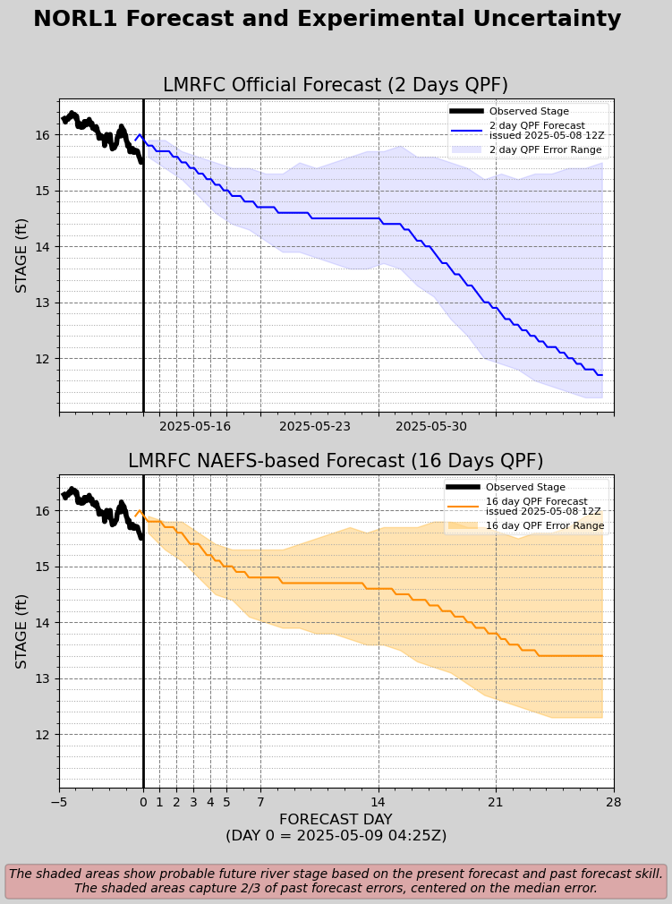
U.S. Corps of Engineers: VELOCITY READING (NEW ORLEANS) -1.9 Knots Mississippi River - Projection- Based off 48 Hours of Forecast Rainfall Mississippi River - NOLA Projection- Based off 16 Days of Forecast Rainfall (Experimental)-
Weather Information: Tropical Weather: Tropical Weather OutlookNWS National Hurricane Center Miami FL800 AM EDT Fri Jun 28 2024 For the North Atlantic...Caribbean Sea and the Gulf of Mexico: 1. Western Caribbean/Southwestern Gulf of Mexico (AL94):A broad area of low pressure over the western Caribbean Seaassociated with a tropical wave continues to produce widespreadshower and thunderstorm activity. Development of this system is notexpected today while it moves west-northwestward at around 15 mph,and an Air Force reconnaissance mission planned for today has beencanceled. The disturbance is then expected to move westward over theYucatan Peninsula and emerge over the Bay of Campeche late Saturdayor early Sunday, at which point some development will be possible.Regardless of development, heavy rainfall associated with thetropical wave will affect portions of Central America and Mexicothrough the weekend.* Formation chance through 48 hours...low...30 percent.* Formation chance through 7 days...low...30 percent. 2. Central Tropical Atlantic (AL95):A low pressure system located about 1500 miles east-southeast of theWindward Islands is gradually becoming better defined. Showers andthunderstorms are also showing signs of organization, and a tropicaldepression or tropical storm will likely form later today or onSaturday. This system is expected to move westward at 15 to 20 mphand approach the Lesser Antilles by the end of the weekend.Interests there should monitor the progress of this system. Formore information, including gale warnings, see High Seas Forecastsissued by the National Weather Service.* Formation chance through 48 hours...high...90 percent.* Formation chance through 7 days...high...90 percent. 3. Eastern Tropical Atlantic:A tropical wave centered several hundred miles south-southwest ofthe Cabo Verde Islands is producing disorganized showers andthunderstorms. Some slow development of this system is possiblenext week while it moves generally westward across the centraland western tropical Atlantic at 15 to 20 mph.* Formation chance through 48 hours...low...near 0 percent.* Formation chance through 7 days...low...20 percent.15-Day Weather Forecast:New Orleans area 15-Day Forecast: http://www.accuweather.com/us/la/new-orleans/70112/forecast-15day.asp?partner=accuweather&traveler=0&zipchg=1&metric=0Baton Rouge area 15-Day Forecast: http://www.accuweather.com/us/la/baton-rouge/70801/forecast-15day.asp?partner=accuweather&traveler=0&zipchg=1&metric=0
Disclaimer: For quality assurance purposes please note well that while the information contained in this website is regularly vetted for accuracy it is not intended to replace the local knowledge or expertise pertaining to port conditions of our marine operations personnel.
Access our team on the go
There are two ways to ensure you can always reach us.
Mobile App
Download our mobile app to search our corporate directory and contact us.
Print Directory
Download and print out our foldable portable directory for quick access.